From archive to online: History majors take on digital humanities
With GPS as the most common form of everyday navigation, cartography may seem like a lost art. But two History majors spent the summer with Associate Professor of History Qin Fang using digital tools to make centuries-old Chinese maps interactive and accessible.

With GPS as the most common form of everyday navigation, cartography may seem like a lost art. But two History majors, David Bradley and Olivia Usilton, spent the summer with Associate Professor of History Qin Fang studying cartography and using digital tools to make centuries-old Chinese maps interactive and accessible.
“I was really excited to join Professor Fang on this project because I had never truly learned about reading maps,” says Bradley, a senior from Westminster, Maryland. “As a History major who hopes to get my master’s eventually, I’ve learned useful research skills.”
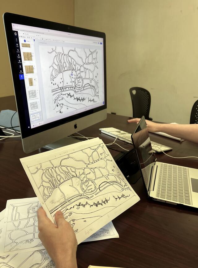
To begin their work in digital history, Bradley and Usilton examined a series of maps featuring a city in the Hangzou Bay region in China. The maps, from the years 1681, 1765, 1775, 1840, and 1922, allowed the students to compare differing representations of a single region and examine how it has changed over centuries.
Fang’s research interests involve regional history in early modern China, particularly through a lens of gender and sexuality, and she has conducted research with McDaniel students for seven years. She compares the Hangzou Bay region to Maryland’s own Chesapeake Bay region, especially when considering how human settlements influence and are influenced by ecological changes in an area.
The students worked to develop their “cartographical literacy,” says Fang, by identifying major landmarks and the conventions of Chinese maps from each time period. Historical Chinese maps, according to Fang, are often illustrative and represent a map-maker’s directional orientation and familiarity with an area.
Many were transcribed from other versions, which leads to missing place names, unclear cardinal directions, and conflicting landmark placement. “Some of the maps were different based on what their purpose was,” added Bradley, such as one intended for travelers versus one used by local officials.
“Maps are political, and illustrations are political,” Fang says. “When you decide what will be included and what will be left out, that reveals which concerns are more important, and that’s what we try to figure out.”
Usilton, a senior History major with a minor in Education, first had the idea to make the maps interactive using online software to solve a labeling issue. “I was staring at a map wondering how I was going to get 130 little boxes around the edges. And I was like, ‘There’s no way this is going to work,’” says Usilton, who is from West Chester, Pennsylvania.
Through her Education minor, Usilton had experience with Genially, a software that would allow the group to create interactive images with labels — one map has more than 150 — that appear at the click of a mouse. By creating digital versions of the maps, the students were able to compile an easily accessible resource for anyone investigating the region.
Usilton conducted research with Fang last year, but cartography was a new subject, she says. “I have a new appreciation for mapping. When we think of maps today, we think of our phones. Redrawing the maps made me realize how much detail goes into creating one,” she says.
"I want to show them that in doing history, you are teaching other people how to read that part of history while also coming up with your own questions."